In March of 2015, our family took a trip to Vietnam. Here is a video documenting our travels throughout the country.
In March of 2015, our family took a trip to Vietnam. Here is a video documenting our travels throughout the country.
A video compilation of our September 2014 hike of Mt. Fuji in Japan. Enjoy!
Have you ever gone for a walk inside a cloud? And I’m not talking about that time you and your college buddies went to Amsterdam and things got…hazy. I’m talking about the real thing: a visible mass of condensed water vapor floating high above the ground. Don and I were lucky enough to experience this bizarre phenomenon during our visit to Deogyusan National Park. While the cloud coverage at the peak of the mountain didn’t give us the breathtaking views we are accustomed to, it did result in a once in a lifetime experience.
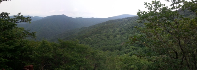
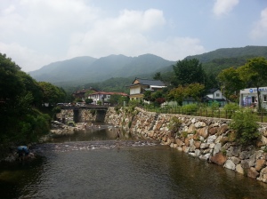
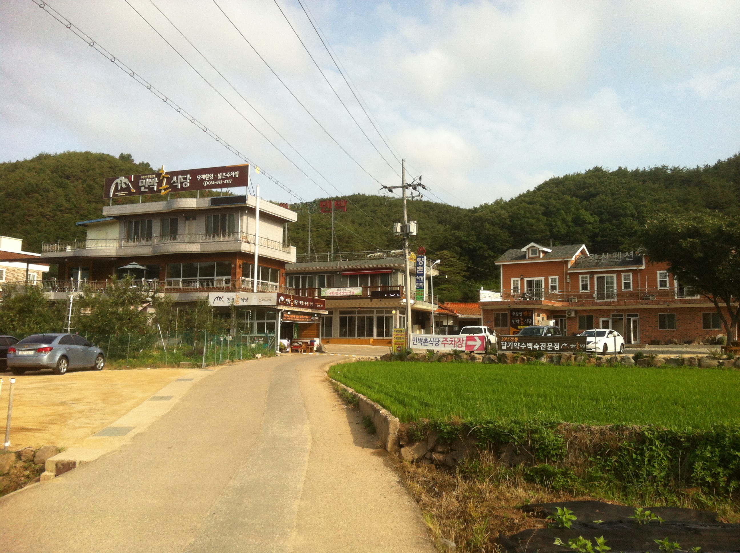
We spent the week watching the weekend forecast with fretful anticipation. We had resolved to hike at Deogysan regardless of the weather, but the idea of climbing a mountain through a thunderstorm was a gloomy prospect. Fortunately, the rain gods saw fit to unleash their fury in the days before, leaving the trails wet, but Don and I dry for the most part. We arrived in Gucheondong (구천동), a village near the Muju Ski Resort, after a 3-hour journey from Nambu Bus Terminal in Seoul. The town was like the Disneyland of national park towns. There was a live band playing to a crowd of families and adjummas (who were awkwardly clapping off-beat as per usual), people setting up camp by the mountain stream, and children and college students engaging in water warfare from a various array of inner tubes. The town seemed to be teeming with activity, which is a rare sight in comparison to some of the other sleepy parks we have visited.
One thing you might not know about Don is that he loves loops. Like really loves loops. Every park we go to, he tries to convince me that the best course of action involves some kind of looping trail. Deogyusan was no different, and I, being the great girlfriend that I am, indulged in his loop obsession. The course we chose would take us to three peaks: Chilbong (1,307m), Seolchunbong (1,520 m), and Hyangjeokbong (1,614 m).

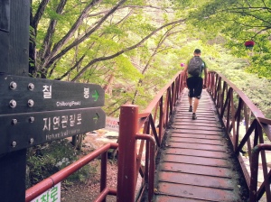
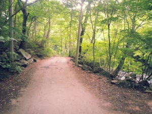
The hike started fairly easy as we walked along a service road beside the river. After about 1.5 km, we came to our turn off point towards Chilbong. The two trails were like night and day. The “path,” if you can call it that, weaved through a forest teeming with life. The lush, green trees made for beautiful scenery, but often covered the trail, meaning we had to pay close attention that we were, in fact, still going the right direction. Though most other parks have clearly marked trails and signage, this particular trail was nothing more than a barely-discernable series of rocks and boulders we were forced to scramble up. I’m not going to lie, it was pretty hardcore, and it really made me come face-to-face with my fear of spiders. It was, however, one of our favorite trails thus far. Sometime, the trails tend to blur together, but this one was definitely unique and will not be easily forgotten.


 Upon reaching Chilbong, we discovered that it was little more than a popular hangout for the myriad of insect-life on the mountain. After a short break, we left the dragonflies behind and continued on our way. The next portion of the trail was equally unique. We trekked along the ridge on an overgrown trail. At times, the undergrowth was so thick we could not see our feet as the leaves slashed at our legs, leaving us with a few scrapes to take home with us. It felt like we were in a completely different country, and it reminded us of a time when tigers still roamed the vast landscape.


 After about a kilometer, the path ended at one of the many ski slopes lining the mountain. This is where the hike got peculiar. We began the slog up the ski slope, which was not particularly steep, but just enough to really tire out our legs. Soon, the clouds rolled in. It took about 10 minutes for the mountain to become completely enveloped in a grey fog, often reducing our visibility to about 10 feet. There was a strange silence all around us as we continued up the abandoned slope. Occasionally, as the fog would shift, we would catch glimpses of unused ski lifts with their seats eerily shifting in the breezes.


When we neared the top, we could hear faint sounds of old music and voices. Remember that scene in The Shining when Jack imagines a party in the ballroom? Walking up to Seolchunbong was similar to that feeling. Suddenly, figures started to immerge from the fog. While we had only seen 4 people up to this point, people suddenly surrounded us. It was here that we remembered that there was a cable car that conveniently brought people up to the top, allowing them to make a short 600 meter hike to the highest peak. So there we were, muddy and scraped and tired, surrounded by energetic children, women in bejeweled sandals, and old men talking on their cell phones. Oh, and all of this is in a cloud of fog. It was a bizarre experience to say the least.

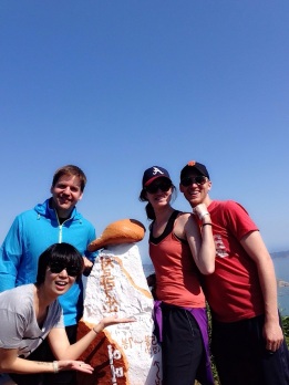
The rest of the journey to the highest peak, Hyangjeokbong, was on a well-maintained path, suitable for people wearing high heels (I saw a few). At the top, you could really distinguish between those who were tourists and those who had made the climb, mostly by the amount of mud on their body. At the top of the mountain, we got our picture taken and settled down for some snacks and makkeoli. We could see nothing, as we were literally inside a cloud, but we enjoyed our makkeoli and rested our legs. No matter what the circumstances, view or no view, reaching the highest point on a mountain is a cathartic experience. Whatever troubles plague you, for a moment, they are forgotten, and you can just relish in the huge feat you’ve just accomplished. Deogyusan was no different.


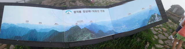
What the view should have been
The hike down was much easier than the hike up. The trail we chose was apparently more commonly used than the one we took up the mountain, complete with functional stairs and clear signage. It was refreshing after all the oddities we encountered on the way up. The trail spit us out at Beangnyeon Temple, a quiet little complex tucked onto the mountainside. There we met a few Korean men who were slowly making their way up to one of the shelters at the top. They insisted on taking pictures with us and sharing some Pocari Sweat, and unfortunately named but pretty delicious sports drink.


From the temple we still had an additional five plus kilometers to walk back to the park entrance. The walk was mostly along a paved road that ran parallel to a beautiful mountain stream. In a lot of ways, this was the hardest part of the hike. You’d like to think that once you’ve climbed up and down the entire mountain you’d be done, and usually that’s exactly what your brain does. We got to the bottom, threw in the towel, and then still had to walk for another forty-five minutes. But we made it. We always do.

Trout hatchery
Upon making it back to Gucheondong, seeing the manliest Korean dude ever, and high fiving our newest accomplishment, we found a nice mountain restaurant that served samgyeopsal (thickly-cut Korean bacon) and a local variety of makkeoli called cheon-seol-ju. The meat was exactly what we needed after our long day, that and some soju. After dinner we wandered around until an old lady totally strong-armed us into renting a room in her hotel. It wasn’t the nicest place we’ve ever stayed, but we had to admire her hustle.


Deogyusan wasn’t the most beautiful park we’ve been to, but in many ways it was the most memorable. The village was busier than any we’d ever seen; the trails made us feel like we were actors in a Vietnam war movie more than day-hikers enjoying a stroll; and the cloud at the peak made sharing our celebratory drinks an experience that Don and I will cherish for a long time to come. In every way possible, Deogyusan reminded us why we’re doing what we’re doing. It just makes us feel good.
Getting There:
From Seoul, you’ll need to take an intercity bus from Nambu Terminal, located just off the orange, number three subway line, to Muju. Buses leave five times a day (07:40, 09:20, 10:40, 13:40, 14:35), cost 13,400 won, and take about two and a half hours. Tickets can be reserved from busterminal.or.kr (no English service). From Muju Terminal, take a bus to Gucheondong. They leave regularly. Alternatively, if you’re an early riser, grab the 7:40 bus from Nambu Terminal and take it directly to Gucheondong for 17,600 won. Buses leave from the bus stop in Gucheondong regularly to several destinations including Seoul (1:40) and Daejeon (seven times daily).
Korean mountains have a funny way of teasing you. With all the stairs, lookout points, and ups and downs on the way to the peak, it’s easy to get fooled into thinking you’re in the homestretch. Casey and I learned this lesson early on in our Korean national park adventure. On our very first hike at Woraksan National Park, I kept reassuring Casey that there was only one “final push” before the peak only to be proven wrong about half a dozen times. I lost a little bit of credibility that day, but we did eventually reach the top.
That first hike really set the tone for our adventure through Korea’s twenty-one national parks. Though our quest has been fun, awe-inspiring, and fulfilling, it hasn’t been without its challenges. This recipe of adventure and difficulty has held true for nearly all of our trips, and even now as we truly are in the “final push” of our journey, it was no different at our fifteenth destination, Juwangsan National Park.

Juwangsan is arguably Korea’s most inaccessible national park. Located in Gyeongsangbuk-do, the park is about as isolated as you can get on the peninsula without being in North Korea. The only sizeable nearby city is Andong, and even that is an hour’s drive away. Getting there from the Seoul area is a bit of a hassle, but not impossible considering this is Korea, the land of efficient public transportation.
Casey and I arrived on a Saturday afternoon after a long, four and a half hour bus ride from Dong Seoul Bus Terminal. Conveniently, daily buses from Seoul run directly to Juwangsan. Inconveniently, the bus’s primary destination is Andong, meaning a series of stops in a number of tiny hamlets on the way to the national park. We were a bit unsure of the facilities at Juwangsan before we arrived. A number of blogs indicated that places to stay were few and far between and those that were available were overpriced, grungy minbaks. We were pleasantly surprised, however, as there were a number of new places to stay across the street from the tiny bus terminal, including a well-maintained campsite just down the road. We ended up opting for a room in a pension that included a bed, flat-screen TV, kitchen, and a balcony complete with tables and chairs for 50,000 won. The room was much nicer than the majority of love motels we’ve stayed at for the same price. So unless you’re going in the fall to see the leaves, you shouldn’t have any problem securing a place to stay.


After some makgeolli and a few Korean pancakes (a must-eat dish, and one you’ll find at the base of virtually every mountain in Korea), Casey and I spent the evening on our balcony relaxing and enjoying the stunning view of the massive rock faces looming over the entrance to Juwangsan.

We woke up early the next day to start our hike. Like many other parks, the road into Juwangsan is lined with restaurants and stores. Casey and I stopped to pick up a bottle of homemade dongdongju, a regional variant of makgeolli, for the peak and were promptly given a series of free samples by a very kind woman working at the Healing Spoon, one of the first restaurants past the bus terminal. Two things of note here: 1) this was only the first in a long series of extremely kind people we met at Juwangsan, and 2) multiple bowls of makgeolli is an excellent way to start a hike at 8:00 in the morning.

Just past the ticket booth (2800 won per adult), lies Daejeonsa, a fifth century temple currently under renovation. Following the road that wraps around the temple complex, we soon came to a fork in the road. Most visitors to Juwangsan head left here, along the path that offers quick and easy access to Jubong Valley, the true gem of this national park. Casey and I went right and headed to the peak of Juwangsan before continuing on and around in a loop that would lead us the back way through Jubong Valley.


Map at the peak of Juwangsan
Hiking is like anything else, some days everything feels right and you feel wonderful, other days you question why you even got out of bed. This was one of the latter days. The peak of Juwangsan is only 720 meters high, making it one of the shorter mountains we’ve attempted in the past year and a half. Unfortunately for us, relatively short heights don’t always translate into easy hikes. Although there’s no explanation for it, we struggled to the top. Anyone experienced with Korean hiking could be expected to complete this trail relatively easily, yet we still struggled. After an annoyingly difficult hour and a half, we made it to the top and cracked open our bottle of makgeolli.


Though the peak was lined with trees that blocked any possibility of a view, it was quiet and peaceful. On the way to the top we encountered exactly four other hikers, making it possibly the most unpopulated hike we’ve ever been on in Korea. After snapping a few pictures and relaxing for a bit, we headed on to complete our loop. The northerly trail from Juwangsan was longer than the way up, but because it was nearly all downhill we were able to complete it quickly and with little difficulty. If you plan on doing the same hike, I suggest following in our footsteps and heading to Juwangsan first in order to avoid the added strain on your knees. On the way down to the valley we started running into more groups of hikers. Everyone was quick with a hello and we were given cucumbers and hard-boiled eggs by fellow hikers along the way. Maybe it was the relative isolation or just the surprise of seeing foreigners on the trail, but the brethren of hikers was strong at Juwangsan.
The final leg of the loop spit us out through Jubong Valley. Viewed from the top of the mountain, the valley is a series of rock faces that, while stunning, somehow pales in comparison to the effect of walking through them below. Jubong Valley is simply one of the most beautiful places either of us has visited in Korea, easily rivaling Seoraksan’s Ulsan Rock in both beauty and raw power. The path is a perfectly maintained wooden walkway between the rock walls that meanders above a clear stream. Though the numerous waterfalls, like most others in Korea, are less than impressive, the rest of the gorge more than makes up for it. Unsurprisingly, Jubong Valley is packed with sightseers and photo-seekers.


Reaching the southern end of the valley, we found ourselves once again at Daejeonsa. The entire loop took us around four hours to complete with generous breaks. After purchasing bus tickets back to Seoul through the confusing machine in the terminal, we headed back to our favorite makgeolli lady for some lunch. Juwangsan is well known for apples and we tried an apple bibimbap that proved to be delicious. After picking up a bottle of apple liquor, we boarded the bus for what proved to be a hellish trip home. Once again, all the stops between Juwangsan and Andong ate away at our Sunday afternoon. We tried to pass the time by watching a movie, but the traffic jams as we got closer to Seoul proved to be too much. Even our three-hour movie was over at least three hours too soon. This is a common problem with Sunday bus rides back to Korea’s capital and one we were mentally prepared for, but it was still miserable.


And so that is how it goes when you travel in Korea, or anywhere else really. You can find yourself in the middle of nowhere. You can be surrounded by natural beauty and the kindness of absolute strangers without a common language. You can share a unique experience with someone you love. Yet an easy hike can turn into a challenge because its simply not your day and you can find yourself on an eternal bus ride with a pounding headache and nothing to do. But for all that, the journey was worth it. Juwangsan is a special place that should not be missed because of its location. Make the effort. Take the trip. You will be rewarded.

Getting There:
Despite the distance from Seoul, Juwangsan is relatively easy to get to compared to some other parks. Direct buses via Andong and a number of smaller towns leave from Dong Seoul Bus Terminal, outside Gangbyeon Station on Seoul’s green subway line, daily (6:30, 8:40, 10:20, 12:00, 15:10, 16:40). Juwangsan is the final stop and without traffic the ride should take around four and a half hours. Bus tickets can be purchased online at www.busterminal.or.kr (all Korean).
Our friend got married last week…in Bangladesh. We were fortunate enough to be there…sort of. It was a whole long schedule events unlike anything we’d ever seen before. Although we missed the actual wedding, we got to be a part of a lot of other things and we’re grateful. It was an amazing and unique experience. Hopefully the video captures some of that.
Casey and I like our baseball wherever we can get it, but our favorite place to see a game in Korea is probably Jamsil Stadium in East Seoul. Jamsil may not be the prettiest stadium, nor the cleanest, most well stocked, or most comfortable, but it’s size, location, and atmosphere are hard to beat.

Built in 1982, Jamsil holds around 26,000 people and is a huge concrete monstrosity typical of the era. If you ever went to St. Louis’ Busch Stadium, Cincinnati’s Riverfront Stadium, or Pittsburgh’s Three Rivers Stadium, then you’ve been to Jamsil. It’s big; it’s round; it doesn’t have much character. But damn it, it does the job. Though Jamsil has recently gone through some renovations, it’s essentially the same structure it was thirty years ago as all the changes had more to do with maintenance than with upgrades.


After two years of construction, Jamsil opened its doors for the inaugural season of the KBO as the home of the MBC Chungyong, the team that became the LG Twins in 1989. Jamsil remains the home of the Twins today, but also hosts the Doosan Bears, making it the only stadium in Korea to house two teams. Originally playing in Daejeon, the OB Bears moved to Seoul in 1985 and played one year at the now non-existent Dongdaemun Baseball Stadium before moving to Jamsil in 1986. It wasn’t until 1999 that the OB Bears became the Doosan Bears.


Slightly Tangential Historical Side Note: Jamsil hosted baseball at the 1988 Seoul Olympics, the last Olympics before baseball became an official sport four years later in Barcelona. South Korea advanced all the way to the semi-finals, eventually losing to Puerto Rico in the bronze medal game (apparently medals were awarded but they weren’t real medals). The gold medal game was a rematch of the 1984 final with the United States edging the reigning champions, Japan, thanks to two home runs from Tino Martinez and a complete game by Jim Abbott. Another favorite, Cuba, boycotted the games due to its alliance with North Korea. Similarly, the heavy-hitting nations of Albania, Madagascar, and the Seychelles also abstained due to their friendship with North Korea. Seriously, I can’t make this stuff up.

Okay, back to Jamsil. Located in the Seoul Sports Complex, the stadium is easily accessible by subway. The convenience of its location is a big factor for Casey and I. We live just south of Seoul, so a relatively quick forty-minute trip on the subway drops us off right in front of the stadium. Similarly, Gangnam, along with its myriad bars and restaurants, is only three subway stops away. Not a big deal, but compared to the wasteland of entertainment and food surrounding Seoul’s Mokdong Stadium to the west, it’s a big plus. Again unlike Mokdong, the tickets at Jamsil are super reasonable. Outfield seats will run you about 8000 won (around $8 US). Like most of Korea’s stadiums, the outfield bleacher seats are unassigned, allowing you to sit in any seat you want as long as no one has already claimed it. Casey and I have probably been to about a dozen games at Jamsil and we’ve never actually sat anywhere other than the outfield. It just feels right somehow.


Unsurprisingly for the thirty-year-old stadium, amenities are not one of Jamsil’s high points. It simply wasn’t built for anything other than baseball, and I suppose that’s understandable. Go for the game and enjoy it, don’t expect anything else. Food options, however, are impressively diverse. Lots of western options such as KFC and Burger King, along with some pizza shops, line the outside of the stadium. The chicken is generally cold and soggy, but the burgers are decent and it’s hard to screw up pizza. Korean options are readily available, too, with everything from spicy rice cake to blood sausage. If none of that is appealing to you, bring whatever you’d like as the only things not allowed inside are glass bottles of soju (plastic bottles are fine). A few convenience stores are set up as concessions inside the stadium where you can get basic snacks and tall cans of beer at ridiculously low prices.

What makes Jamsil really stand out is its atmosphere. As far as I’m concerned, there is little better in Korea than catching a baseball game at Jamsil on a sunny afternoon. You can relax with a beer or five, catch some generally charmingly clumsy play, and be part of the spectacle that is Korean baseball. Though there are better stadiums in Korea, there might not be a better place to see a game. Located on a main subway line in one of the busiest cities in the world and the biggest city in Korea, fans from all over the country regularly fill a good portion of the seats. Even if you’re seeing a team from the south that made the trip up to face the Twins or Bears, they’re virtually guaranteed to have a big crowd cheering them on because so much of the population has migrated to Seoul in the last few decades. The big crowds really separate Jamsil from all the other stadiums and make otherwise dull games exciting.
Jamsil isn’t my favorite stadium in Korea (though it is Casey’s), but there’s nowhere else I’d rather see a game. If you can only get to one game in Korea, make it one at Jamsil. Unless it’s a playoff game or a rare Saturday/Sunday game between the Twins and Bears, tickets should be readily available. Though there’s been talk of a new stadium in Seoul for a while now, Jamsil should be around for quite a few more years and that’s just fine with me.

Getting There:
Take subway line 2, the green line, to Sports Complex Station and head out exit #5 or 6. The stadium will literally be right in front of you.
An amazing hike with some some amazing friends in Naejangsan National Park. Enjoy!
A highlight reel from our four day adventure through Byeonsanbando and Dadohaehaesang National Marine Parks.
With a long six day weekend ahead of us, Casey and I made plans to visit our three remaining marine national parks: Byeonsanbando, Dadohaehaesang, and Hallyeohaesan. Plans, of course, is a relative term, especially for us because we are not good at them. Generally this lack of strategy serves us fairly well, and this trip was no different until some hiccups on the backstretch. So on an early Thursday morning, armed with a tent, some sleeping bags, and what turned out to be way too many clothes, Casey and I, along with our friend Suzie, found ourselves on a bus to Buan, a sleepy town a little more than halfway down South Korea’s west coast.


Our first stop on the six-day journey was Byeonsanbando National Marine Park. As the only national park located on a peninsula, Byeonsanbando is a unique mixture of coasts and mountains. The coastal parts of the park, referred to as Oebyeonsan, are characterized by beautiful cliffs and beaches, while the mountains, or Naebyeonsan, are memorable more for their beauty and location than for their relatively low peaks. During our two days in Byeonsanbando, we made sure to experience both, heading first for Gyeokpo, a rocky but lovely beach along the East China Sea.

Gyeokpo was immediately surprising as it is unlike most other beach towns in Korea. Casey and I have been to several beaches on both the west and east coast of Korea, and invariably the towns are charmingly run down. Not so for Gyeokpo. I have no idea where the money came from, but someone clearly threw a lot of it at Gyeokpo in an effort to bring in those sweet, sweet tourist dollars. Don’t worry about supplies if you find yourself heading toward Gyeokpo. Restaurants, hotels, and convenience stores are virtually everywhere. Unlike other beach towns that have only one strip of stores and hotels lining the beach, Gyeokpo has a number of blocks, flanked by a few resorts to the north and south, filled with everything you could want


The beach itself is fairly small, but picturesque. On its southern end, tourists can venture out onto volcanic rock and stroll in the shadows of the Chaeseokgang Cliffs. The cliffs are genuinely beautiful and the odd volcanic formations could keep your eyes occupied for a long time. Just make sure you start at low tide because as everywhere on the west coast, the tides move in and out quickly throughout the day, making the cliffs essentially inaccessible from the beach at least twice a day.


Because we were planning for six days of travel, Casey and I opted to camp for a number of nights to cut down on costs. After consulting with a kind elderly woman running a local shop directly behind the beach, Casey and I, with some help from Suzie, set up our tent on the small strip of grass behind the boardwalk, only a stone’s throw from the water. Camping in Korea is amazing. As long as you don’t bother anyone, you can set up camp virtually anywhere for free. Even though our tent was basically parked between a convenience store and a busy restaurant, no one cared that we and a few other groups were sleeping in the middle of town. After we got everything set up, we took a stroll down the coast, checked out the cliffs, and played some cards on the boardwalk. The weather was beautiful, the beer was cold, and the hours flew by as we goofed around until the sunset stopped us in our tracks. Casey and I experienced some amazing sunsets in Honduras earlier this year, but this sunset was strangely mesmerizing. The sun took its sweet time disappearing behind the horizon, giving us an hour long show of colors and waves unlike any we’d seen before. It was, by far, the best sunset we’ve ever seen in Korea and reason enough for you to visit Gyeokpo.


In the evening, we checked out one of the many shellfish restaurants in Gyeokpo. I suspect that most of them are essentially the same, meaning that they’re all equally as delicious. Shellfish barbecue is probably my favorite part of going to the beach in Korea. I love everything about it: the taste, the sassy way the shellfish pop open to let me know they want to be in my stomach, and the sheer variety of things I can eat from the sea. I’d eat shellfish anywhere, but having waves breaking just below your table is icing on the cake.
After a decent night’s sleep on a hard ground in a cold tent, we headed back to the Gyeokpo Bus Terminal, which doubled as a well-used convenience store. We entrusted our bags to an old man in the shop and hopped on a bus inland to Naesosa, a temple nestled below the mountains of Byeonsanbando. Because of the scarcity of buses between the beach and temple, we didn’t actually get a chance to see Naesosa. I assume it was pretty, but because of our tight schedule, we headed right for the mountain trail that begins a few hundred meters in front of the entrance to the temple.


There are a lot of trails in Byeonsanbando and a number of peaks. We chose a trail that led up to Gwaneumbong (424m). The trail was well kept and got rockier the higher it got. Unlike most other national park trails, it was relatively quiet and we didn’t run into many hikers until we were headed down. We only had a few hours to make it to the top, and given the fact that it was a short hike, I thought we would have no problems getting to the peak and back. Walking at brisk pace, we only stopped to enjoy a few of the especially pretty vistas along the way. The sea in the distance paired with the nearly infinite shades of green on display in the mountains in late springtime made it an especially beautiful hike.


As we neared the top, we encountered a number of hairy stretches where we were forced to scramble along a craggy rock face with only a shaky wooden rail separating us from a sheer drop-off. Casey wanted to head back so we wouldn’t have to worry about missing the bus, but I begged her to continue since we were so close. They view from the top was gorgeous, but certainly no more gorgeous from some of the vistas below. While I’m glad we made it to the peak, I learned that day (for about the millionth time), that it’s probably just best to listen to your girlfriend when she says she wants to turn around.


After a quick break, the three of us raced down the mountain. We had about forty minutes to make it back to the bus before it left and we ended up making it with only minutes to spare. Before departing, though, we did pick up a bottle of the local makgeolli from the small village clustered around the park entrance. It came in a really interesting bottle but didn’t taste like much. I guess we just prefer a little flavor in our rice wine. After a quick ride back to Gyeokpo, we picked up our bags, got on yet another bus, and made our way to Mokpo and our next national park.

All things considered, Byeonsanbando was a special experience for us in our national park journey. It was only the second time we’d ever spent more than a day in a park and the first time we’d camped in Korea. With the coast and the mountains, I’m really glad we had the extra time. Usually we’re in and out of the mountainous parks, but it’s a nice feeling knowing you’ve checked one more park off the list while you’re playing on a beach. For whatever reason, the national marine parks of Korea seem to get overlooked and it’s unfortunate. Even if you get to the beach and begin to crave a good hike, the mountains are only a short bus ride away. In fact, visitors to Byeonsanbando would be doing themselves a disservice if they only visited one part of the park at the expense of the other.
Getting There:
The gateway city to Byeonsanbando from the Seoul area is Buan (or Jongeup from the south). You can reach Buan via regular buses from any decently sized bus terminal. From Seongnam, just south of Seoul, a bus to Buan cost 13,000 won and lasted around three hours. From the Buan Bus Terminal, buses to Gyeokpo Beach (the same bus stops at Byeonsan Beach) cost 3800 won. Gyeokpo has its own, highly confusing, bus terminal. Buses to Naesosa run from the Gyeokpo Bus Terminal regularly, as do buses to Buan, Jongeup, and elsewhere. Just don’t assume the time you see is the time a bus will leave. There are multiple companies running to and from the same destinations on different schedules posted on various walls throughout the tiny terminal. The pictures below will give you an idea of the times, but we still aren’t quite sure how in the hell we made it work.

Buan Bus Terminal

Gyeokpo to Naesosa

Different Gyeokpo to Naesosa Times

Big Board of Times from Gyeokpo That May or May Not Be up to Date

List of Bus Times Tapped to a C5ounter at Gyeokpo Terminal

Naesosa to Gyeokpo/Buan
It was a crisp, cloudless morning when we started our journey and stepped from the comfort of our hotel rooms out into the street. We could smell the salty breath of the ocean mixed with the pungent odors of fish and gasoline. Don and I had already made the short walk to the Mokpo Passenger Ferry Terminal at 6 AM that morning to purchase tickets for the ferry. Because there is no way to book tickets in advance, it was important to get to the ferry terminal early enough to beat the throngs of passengers sure to be there later in the morning. At 7:15, the room was packed with people ready to embark. There were several boats being boarded that morning, and we were herded in the correct direction and secured our seats. We were cheerful, the sky was bright, and we had no idea the hell that was to come.
The first hour of the devilish 2-hour journey went smoothly as we sailed past the many islands just south of Mokpo. Then the announcements began to come: “Rough seas in 15 minutes… Be prepared for waves in 5 minutes…” We laughed as a crewmember began handing out sick bags, thinking there was no way it could be that bad. It was that bad. The first waves sent the boat flying in the air, and then crashing back down into the sea. I screamed with terror and held onto Don’s hand as though it was going to save me from the sea. The other passengers squealed with delight, wrongly supposing the severe motion to be a carnival ride rather than Poseidon rising from the depths to snatch us into the ocean. Soon, however, the cheering stopped, as wave after wave continued to pummel the boat.
Up, down, up, down. There was silence as people realized that the fun was over.
Up, down, up down. The silence soon gave way to the unmistakable groans of nausea, as the first passengers succumbed to the incessant thrashing and rolling.
Up, down, up down. For nearly an hour, the sea battered the boat as wave after wave after wave threw us into the air. The sounds of sickness echoed throughout the entire cabin, and while I was able to find inner strength by silently chanting “Stomach of Steel” and by planning my future life on the island (since there was no way I was getting back on a boat the following day), Don was not so lucky. He made it about 45 minutes into the assault before he was scrambling for a bag. When the boat finally docked, I wanted to kiss the ground.


Upon disembarking at Heuksando, I thought there was no way anything could be worth the horrendous ferry experience, but thankfully I was wrong. As our nausea began to subside and we regained our ability to walk in a straight line, we soon set out to find a suitable place to camp. The downtown area, if you can call it that, was rather small with several hotels and restaurants lining the bay. Already we realized the slow-paced lifestyle of the island made it different from almost anywhere we had been before. The bus, which acted more like a public taxi, arrived at 11:00am, and we told the driver the name of the beach we were aiming for, Baenanggimi. After a short 5-minute ride, we hopped off the bus at our private, secluded beach.


After setting up camp, Suzie and I wandered across the street to try and find information about hiking. The main office of the Dadohaehaesang National Park just happened to be located behind the beach, and the enthusiastic park director, Mr. Sim, was ecstatic to have a group of foreigners as guests. I suspect he didn’t speak much, if any, English, so we were so lucky to have Suzie there to act as translator. He talked to her for nearly half an hour, non-stop, about all of the amazing things the park had to offer. He was disappointed that our visit was so short, but he was still very glad to have us. He gave us all sorts of information and brochures about the park and island, including a national park scarf, bookmark, and a big, beautiful book on the Korean National Park system. Since we didn’t have a lot of time, he suggested that we hike the mountains that made up the island, as you could see the entire island from the top. He also suggested we take a ferry around the island, or to the apparently more beautiful island nearby, Hongdo. He reminded us that Dadohaehaesang was a huge national park comprised of many islands. We had picked the island of Heuksando randomly by looking up places to visit on a map. While the national park is huge and we had a lot of options, Heuksando seemed both accessible and exotic. Mr. Sim assured us that there were many other beautiful islands to visit, and was sad to hear we were only visiting the one.


Although we had read that camping on the beaches was illegal at this time of year (May), we had no trouble setting up camp. When we asked Mr. Sim about camping, he said it wasn’t a problem at all. The beach was in a perfect location. It was close to bathroom facilities and the road, which made it both convenient and accessible by bus. It was also close enough to town so we could walk there for supplies if we needed to. The camping area was also equipped with sitting areas and picnic tables, making it an ideal place for groups. The water was rather shallow, so we could wade out quite far, but it was still a little too chilly for swimming. As the tides came in, so did the fish, leaping into the air, almost begging someone to come out with a net and swoop them up. Mr. Sim told us that during the summer, there are so many fish that all one has to do is walk out with a net, no fishing gear required.


When we decided to go for a hike, we waited until we saw a bus drive by and waved it down. The driver of the bus suggested that we pick up the trail from the downtown area. When we got off the bus at the port, we walked up the road behind the main strip. From the bus stop, it was very easy to find and there were signs pointing towards the trailhead. We walked along the winding coastal road for several hundred meters, careful to peek around the curves to make sure there was no oncoming traffic. The trail was clearly marked, and we began our ascent. It was a wonderful trail with multiple vistas overlooking various parts of the island. In between the lookout points was a small winding path through dense forest. Naturally we assigned ourselves character names from our favorite war flicks and pretended we were on an important mission to flank the enemy. Don was that one guy from Full Metal Jacket and I was Captain Winters.


At every lookout point we would stop and enjoy the scenery. Each stop was more beautiful than the last. Our final stop was at the first peak, Chillaksan. From here, we could see all of Heuksando and the many small islands that surrounded it. The weather was glorious, and the sun’s rays were shining down upon us. It was here that Don and I had one of those rare “holy shit I’m in Asia” moments. It is amazing how quickly the strange becomes normal, and a place halfway around the world from everything that you have known can become a home. But here, at the top of a mountain in the middle of the of the East China Sea, surrounded by water and islands, we realized that we were a long way from home, even the home we have created while living in Korea. Here we were, a girl from Georgia and a guy from Wisconsin, sitting on top of an island with two of our closest friends in Korea, a Canadian and Korean, enjoying the same sun that would rise in the west in several hours. It was a cathartic experience, and suddenly the pains of the ferry and the stresses of work washed away. It was a long journey, but I am glad we made it.


 After we reached the first peak, we decided to climb back down the way we had come. There were other options, but we decided this would be easier, since transportation on the island, while available, wasn’t very frequent. I, personally, didn’t like the idea of being stranded in a town with only hongeo (a local delicacy of rotten fish) to eat. When we made it back down, we saw Mr. Sim driving down the road. Of course he insisted on driving us back into town. We asked him for a restaurant suggestion and he drove us to a small alley/street close to the ferry terminal. He said it was nothing special, but he had lunch and dinner there from time to time. From there, his assistant walked us to the restaurant. Though the restaurant was closed, the woman opened it up just for us. We had a delicious meal of some of the juiciest, thickest cuts of samgyeopsal I’ve ever had. We also decided to try some Heuksando makgeolli, which tasted like a combination of chocolate milk and dirt.


We were stuffed and happy when we left the restaurant. We stopped by the pharmacy for some anti-sea sickness medicine and the ferry office to make reservations for the ferry the next day. After that, we walked through town and to the grocery store to get some food and beer to take back to the campsite. We walked home along the water’s edge, enjoying the last of the day’s light. Once we got back to the campsite, we cuddled up in our sleeping bags until we eventually fell asleep.


The next morning we woke up bright and early in order to catch our 9:00 A.M. ferry. Luckily the waters were much calmer that day, resulting in a smooth ride back to the mainland. The wonderful Mr. Sim drove us to the port, stopping to show us some of the important places along the way, such as the Center for Migratory Birds. Scientists on the island catch and tag various birds on their journeys south in order to study the migration patterns of the birds. Mr. Sim also imparted his gratitude for our visit. His love for the island and for the national park system of Korea really left an impression on us. He told us not to look at the beauty of the national parks with our eyes, but rather with our hearts. There is so much more to the parks than mountains to climb or scenery to see. It’s a journey, an experience. We live in one of the most beautiful, unique places on this earth, and it would be a shame to merely look with our eyes.

Getting There:
Dadohaehaesang is a huge national park comprising seven large groups of islands. While some of these islands may be reached via land routes, many others are not. One of the main jumping off points for these more remote islands is the ferry terminal in Mokpo. Getting to Mokpo is easy as it is a big city. Buses and trains, including the KTX, are available from most big cities. Once in Mokpo, city bus #1, which can be caught in front of both the bus terminal and the train station, will take you to the Passenger Ferry Terminal. Four ferries to Heuksando leave the terminal every day starting at 7:50 A.M. and cost 34,300 won. Be sure to get there early because tickets can only be purchased the day of. Once on Heuksando grab a city bus at the bus stop a block in from the docks, you can’t miss it. The bus runs around the island and there’s really only one road. Good luck.
| izoomerizoomer on Video: Mt. Fuji | |
| Valent Lau on Video: Mt. Fuji | |
| CaseyAndDon on Byeonsanbando National Marine… | |
| Kayla on Byeonsanbando National Marine… | |
| Stephanie Trejo on Juwangsan National Park |
